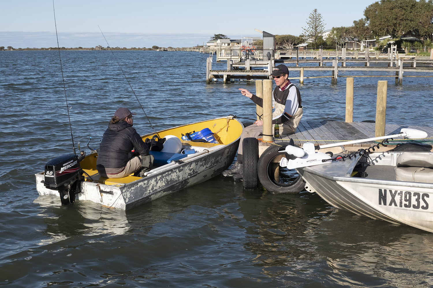
The jetty at my place is sort of the centre of the 2 kilometre radius that I’m primarily concentrating on.
The Mundoo channel is a highway for boats and fishermen. They’re out mainly for Mulloway and Coorong Mullet in the surrounding waterways. There’s a busy boat ramp a few hundred yards up the channel.
Fishermen are always looking for the information about where the fish are biting and my friend @simoncardonefishes on the right is always looking for the latest information.
Simon is often fishing the state’s waterway and his tips are regularly posted on Tackle World’s website and his articles appear in the Fishing SA magazine.
]]>
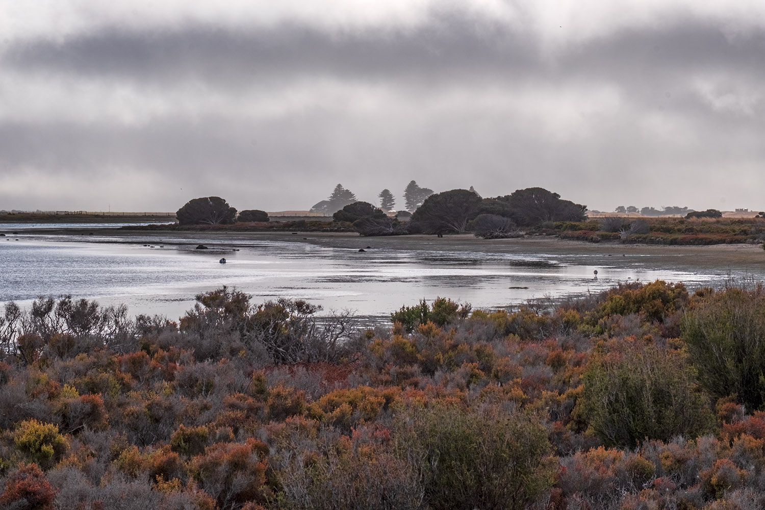
Winter on the coast was an interesting transition from Outback South Australia. It was mostly grappling with overcast skies and marginal light…things that were a small percentage days in the bush.
I’ve got a target of shooting something every day and while I confess at times that has been somewhat difficult there were still opportunities to be had.
This is the Mundoo Channel a couple of hundred yards from my home on one such day. Soft colours but interesting light. There’ll be a few more of these along the way among the brighter days and interesting events around what is My Place.
]]>
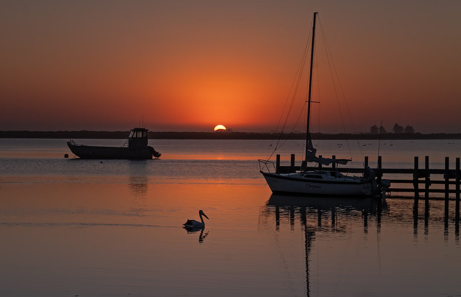
Sunrise on the Mundoo Channel. How peaceful can it get. Appropriate too for the start of something new….. a look at the pictures I’ve taken around where I hang out out now far from the Flinders Ranges and Outback that was my home for a couple of decades.
I must admit the transition wasn’t easy. However I reckon there’s images to be made here too, particularly when it comes to the amazing range of colours that change through times of day, weather and seasons.
The Mundoo Channel is part of a waterway linking the vast Murray River where it flows into the ocean. And it’s connected to the fascinating Coorong coastal lagoon ecosystem. It’s roughly 130 kilometres south of Adelaide.
It’s an area teaming with many species of birds and other wildlife and a mecca for boaties, fishermen, kayakers and nature lovers.
The images to come will mostly be limited an area about 1.5 to 2 kilometres from my place as well as excursions around Hindmarsh Island, the Coorong and the nearby river township of Goolwa.
]]>
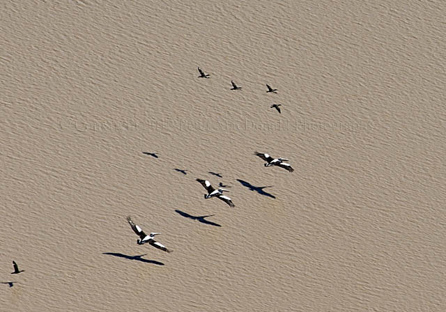
Lake Eyre isn’t all pinks and blues and silver salt.
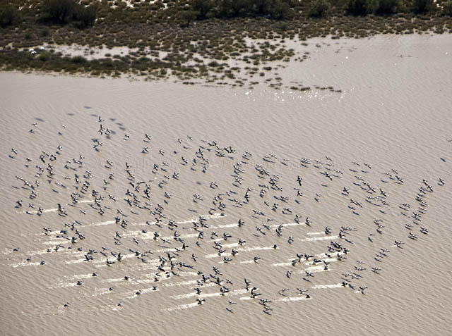
At the top of the main lake and the Goyder Lagoon where some water is flowing in from the Warburton River, it’s quite muddy but there is an abundance of birds.
The pelicans stand out because of their numbers and the apparent ease with which they can glide just above the water’s surface.
However there’s cormorants and black swans. sea gulls, banded stilts and ducks to be seen as well.
There appears to be even more in the Coongie Lake system where the water is fresh and abundant fish to feed on.
]]>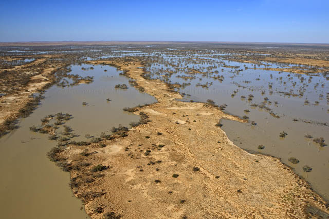
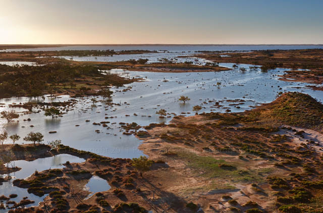
The Coongie Lakes, like Goyders Lagoon to the north – is an almost forgotten fresh water lake system hiding in the shadow of a flooded Lake Eyre.
Home to over 470 plant species -52 of which are considered rare – 180 species of birds, 20 native animal species, 12 native fish and 10 frog species, the Coongie lakes (and there’s hundreds of them ) are a desert wonderland filled from water that falls far away in south-western Queensland.
The lakes are recognised as having international heritage significance.
While thousands flock to see Lake Eyre in flood, they would be well advised to make the extra effort to see these freshwater lakes while they are teeming with wildlife.
The Coongie Lake System is almost full at the moment but the water levels will drop in the the coming months.
]]>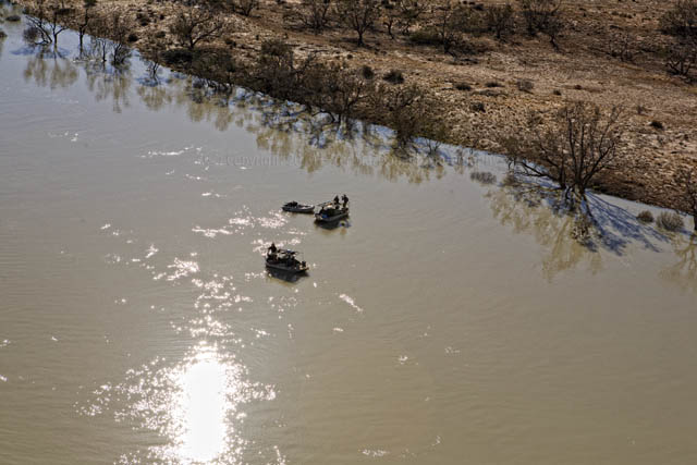
Cruisin’ down the Cooper Creek, a bunch of adventurers head for Lake Eyre.
A quick wave, a chat on the radio and they’re on their own again, with a long way to travel.
]]>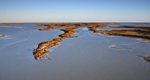
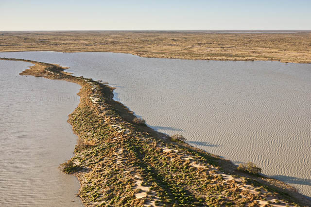
Like giant fingers, the dunes of the Strzelecki Desert reach far into the waters of the Coongie Lakes.
Canon 5D. Lens Canon EF 24-70mm f2.8L USM. Shot at f5.6, 1/500th sec, ISO 200
]]> ]]>
]]>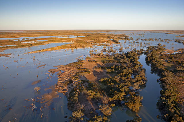
The contrast once again between the Coongie Lakes and the previous photo from Lake Eyre.
Both are very beautiful. Lake Eyre perhaps having the edge.
But to me the contrast is the abounding life in the Coongie system and the lifelessness of the Lake Eyre salt water.
]]>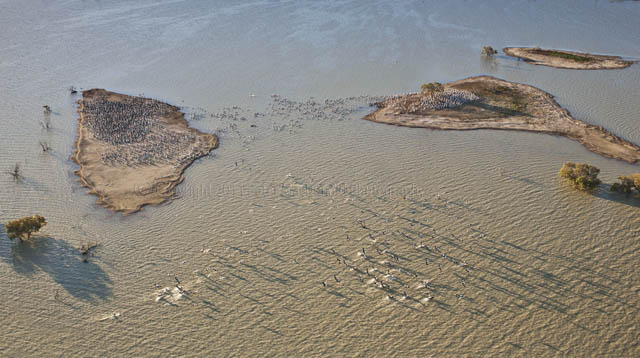
Presumably science still hasn’t come up with the answer as to how these pelicans know when the Coongie Lakes fill with water.
Since it happens only once every decade or longer it’s hard to know how ‘they’ know.
Even birds in Russia get on the wing and head down for a paddle and a bit of mating.
All that aside, it’s even harder to figure out how they can come back to the same island in the lakes to breed.
I mean, when they left, they weren’t much more than chicks and have cruised around our coasts for ten years or so.
This is the same place I photographed in 1999. Click here to look at the island back then (it’s the third photo down). It doesn’t look much like the same place. Yet they know.
Soon, if not already, the larger of the two islands will be crammed with pelicans and not long after that there will be almost as many chicks ready to start the cycle all over again.
]]>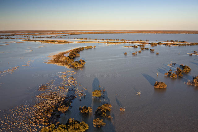
And this is just one of them. The Coongie Lakes – such a contrast from Lake Eyre. Chalk and cheese – Salt Water and Fresh Water.
Unfortunately the Innamincka-Coongie Lakes National Park has been closed until November which is going to hamper many people from seeing this wonderful place at its spectacular best.
However there are some things in the region that are accessible.
It’s best to go to the National Parks site Click Here for the most up-to-date information.
Still the best way to see this area is to stick here with the Sentimental Bloke who will be posting lots more photographs of the Coongie in the weeks to come.
Also try contacting my friends at Wrights Air who I am hoping will have an aircraft based at Innamincka soon.
]]>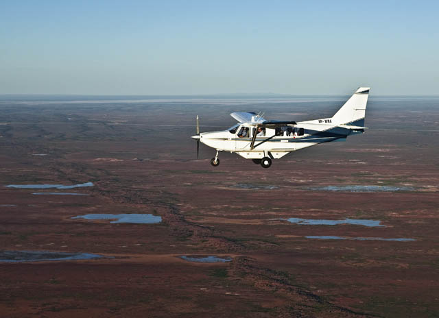
Or soon to be flying in this aircraft once again.
It’s an Australian made GA8 Airvan utility transport aircraft operated by Wrights Air
It’s just the perfect vehicle for photographing the Coongie Lakes and Lake Eyre because I can shoot without having to go through a window.
Pictures from the Sentimental Bloke are going to be a bit thin on the ground for the next 4 days but it means some updated material over the next few weeks.
To be notified by email when the next photos appear, just fill in your email address in the box at the top on the right hand side.
It all happens automatically but your address is still private. The other way is to subscribe via RSS.
]]>
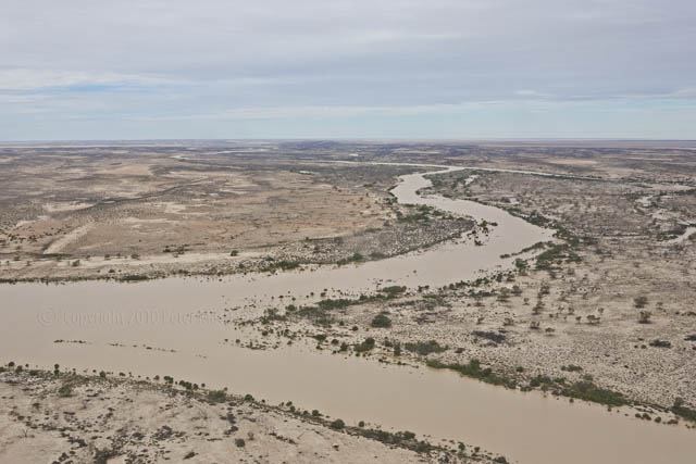
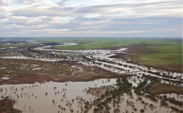
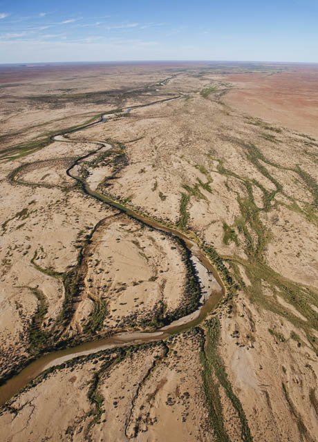
The floodwaters have picked up so much of the surrounding soil, there’s not much to distinguish between the two.
Travelling right throughout the Birdsville Track, Strzelecki Track area at this time is hazardous with some roads cut and others only just passable due to recent rains and flood damage.
Anyone considering travelling by road should access Outback Road Closures, Restrictions and Warnings before setting out.
This photo and the one of the Nappa Merrie Bridge posted on Aptril 12 illustrate why.
]]>
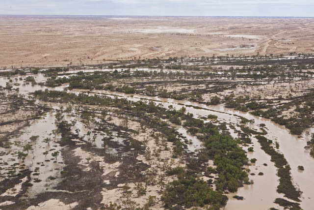
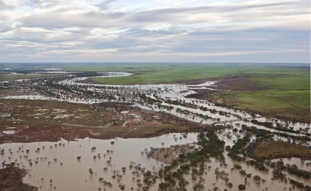
It is hard to visualise just how much land is covered by the floodwaters on Lake Eyre and the Coongie Lakes at the moment.
it is easy to see some amazing contrasts. So much green – shades of green that in some places defy belief.
Then there’s the normal colours of the desert interspersed with streams like the Cooper Creek that have burst their banks in countless places.
I am getting emails from people wanting to travel to the area in the months to come.
The main question being – will there be lots to see by the time we get there. In short, the answer is that the rest of this year will will remain a wonderland out there.
The Lakes will erupt with fish and bird life as well as plenty of healthy vegetation. The Coongie Lakes will probably hold water for a time next year.
Clearly William Creek will be the epicenter of all this activity and it would pay to contact the William Creek Hotel ( [email protected]) about accommodation and camping facilities etc.
Similarly you would be best advised to book with Wright Air for flights.
/>
Arkaroola Wilderness Sanctuary and the Prairie Hotel (Parachilna) will also provide fixed-wings flights over the waters.
Similarly flights will go from further south at Rawnsley Park Station.
Access to the area will also be made in time from Birdsville in Queensland and Innamincka on the Queensland, South Australian border once roads in those areas have dried out.
There’s an expression …”Don’t give up your day job….” As a travel agent the Sentimental Bloke will probably make a better photographer than a travel agent but there’s plenty of people who can help you.
Just use the links and the telephone for up-to-date information.
Travelling in this part of the world requires a bit (maybe a lot) of preparation.
]]>
In the Simpson and the Strzelecki Deserts there are giant sand dunes that mostly run north to south.
Sometimes they are high as 60 metres (200 feet).
From the air the dunes around the Coongie Lakes look like giant veins.
In places the flood waters are just arriving.
In others the waters are already filling the sands between the dunes. They’ll hatch millions of fish eggs lying dormant in the sands.
About the best map I can find of the Coongie Lakes and Lake Eyre where the food waters are flowing is
link
The waters are running in from the Cooper Creek to the East and the Warburton Creek and Diamantina River are filling Lake Eyre from the north.
Flying over this area over the last few days in a Wright Air Cessna 207 certainly was the way to see this spectacular part of Outback Australia.
Both images taken with Canon 5D Mk 1, Canon Lens 24-70 mm f2.8L USM Zoom. First shot f22 1/60 ISO 400. Second Image f16 1/100 ISO 400, polarising filter.
]]>At the moment a once-in-a-decade (or even longer) phenomenon is occurring out there. It’s water – more than can be imagined and it’s turning harsh, dry deserts into the Garden of Eden.
Over the last few days I’ve taken a group of people to see the waters in Lake Eyre and the Coongie Lake system in the northern part of South Australia.
First stop Olympic Dam where we met up with two light aircraft for the rest of the journey which was scheduled to take in the waypoints of Innamincka, Birdsville and William Creek.
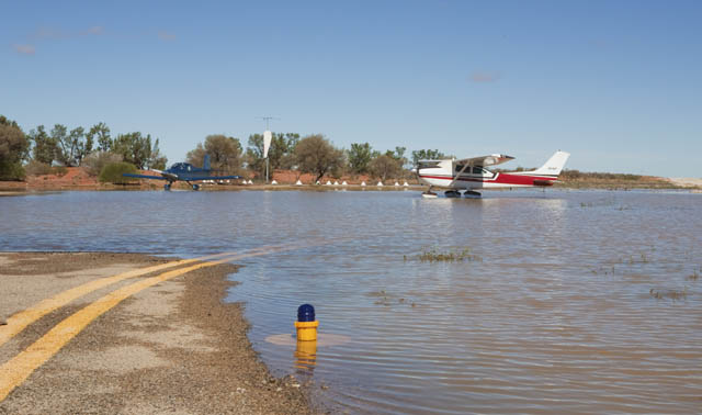
As we land at Olympic Dam , the remnants of floodwaters from unexpected thunderstorm which dumped rain over a widespread area are clearly visible.
The township of Roxby Downs and the nearby giant BHP mine at Olympic Dam received 86 millimetres or just over three inches of rain overnight , 24 hours before we arrived.
This was the scene at Roxby but the storms meant no possible landing at Innamincka which had already been cut off by road for many weeks now and is likely to be for weeks to come.
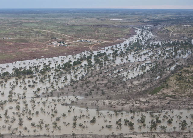
The Cooper Creek which passes just a hundred metres or so from the town is swollen with waters that have come down from the Channel Country in Queensland.
These waters are filling the nearby Coongie Lakes – Australia’s largest fresh water lake system – a rare and spectacular sight.
Fifty kilometres upstream and across the border into Queensland, the Nappa Merrie Causeway is cut by the flood waters which means long isolation for many cattle stations and mining sites.
‘
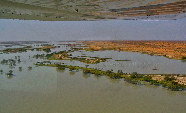
It’s hard to image that this is the Strzelecki Desert. The lush green colour that now covers the plains for many kilometres is something more akin to a prime Victorian grazing pastures.
I’m just beginning to process some of the images I took on this flying tour and over the next few weeks I’m planning to post lots more as well as provide information and links on how best to see the waters.
]]>
Something pretty exciting is happening in the Outback of South Australia.
There’s a vast inland sea building there. The most rains in a decade have drenched the Strzelecki and Simpson Deserts leaving huge areas awash with floodwaters which will fill Australia’s largest freshwater inland system, the Coongie Lakes.
Most years these two deserts are beautiful but inhospitable places. However with rain, they transform into a natural wonderland.
In the fast evaporating waters from the last flooding perhaps 10 to 15 years ago, millions of fish eggs lie in the burning sands.
When the waters come these eggs hatch and a seething mass of fish fill the lakes.
Somehow in nature’s mysterious way, birds from all over Australia and as far away as Russia began to arrive in legions, feasting on the vast schools of fish.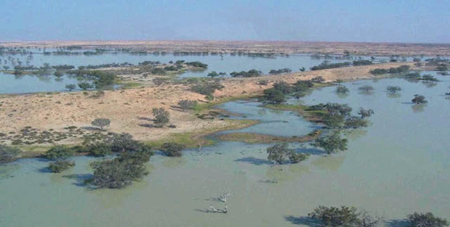
I watched all this the last time it happened in 1999 and 2000, flying many times over the lake system.
While the pictures are pretty average, shot one handed through the perspex of my aircraft window, they illustrate the extent of the waters.
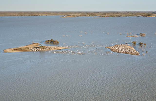
In this one, small islands in the lake system become the spawning ground for thousand of pelicans. They mate here and stay while their young grow strong – feeding all the while on the abundance of fish.
The shot was taken almost at the end of the cycle so many of the birds have moved on.
While it impossible to reach at the moment – in the months to come when the roads and tracks dry out, it will be something really worth seeing.
]]>